Three new COSPE courses on Geomatics as a tool to support International Development Cooperation projects.
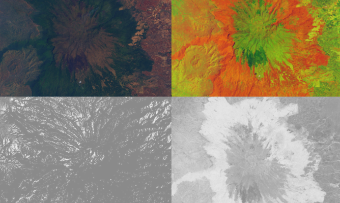
Thanks to the continuous increase in the availability of open source software and open data, the various components of geomatics, such as GIS and satellite data, are increasingly used also in international cooperation projects to provide tools to support decision makers in multiple sectors in the socio-economic, environmental, rural development, health and in any sector where there is a geographical territorial component.
The first course “Use of remote sensing data for Development Cooperation” (9 hours) is aimed at anyone who wants to acquire or improve their skills in research, analysis and use of the most widespread open satellite data and insert them in the various phases in the context of international cooperation projects.
The second course “Field data collection with open source technologies” (6 hours) is aimed at anyone who wants to acquire or improve their skills on planning and data collection procedures in the field, reducing both the time needed for their analysis and the risk to make mistakes in the different design phases.
The third course “Vector data analysis using Open Source software” (9 hours) will deal with the tools to work on punctual, linear and polygon-based cartographic information both in terms of their geographical aspect and that of the connected tables.
Only open source applications and software (mainly for Android) will be used to ensure the sustainability and future replicability of the training contents and methods.